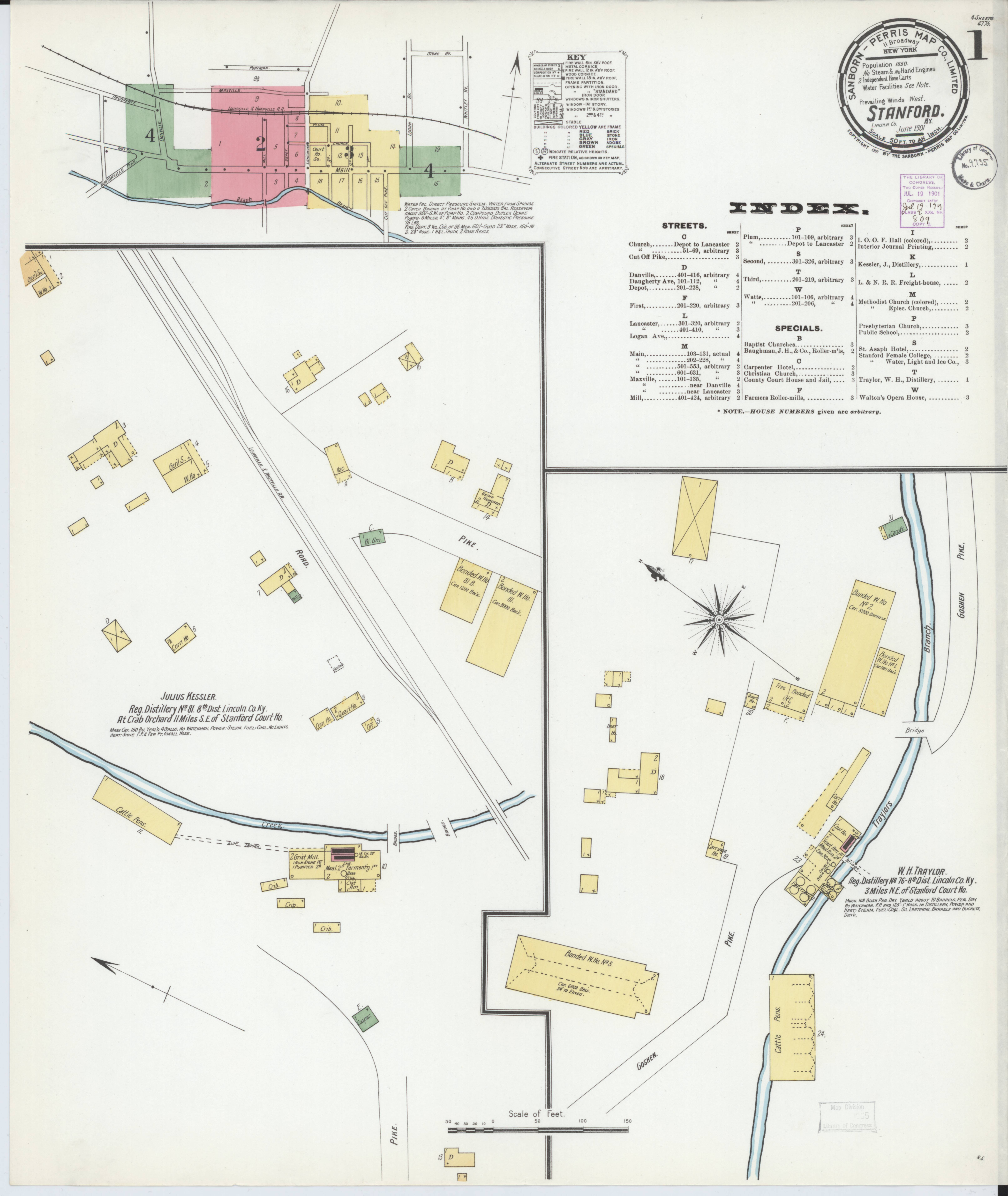
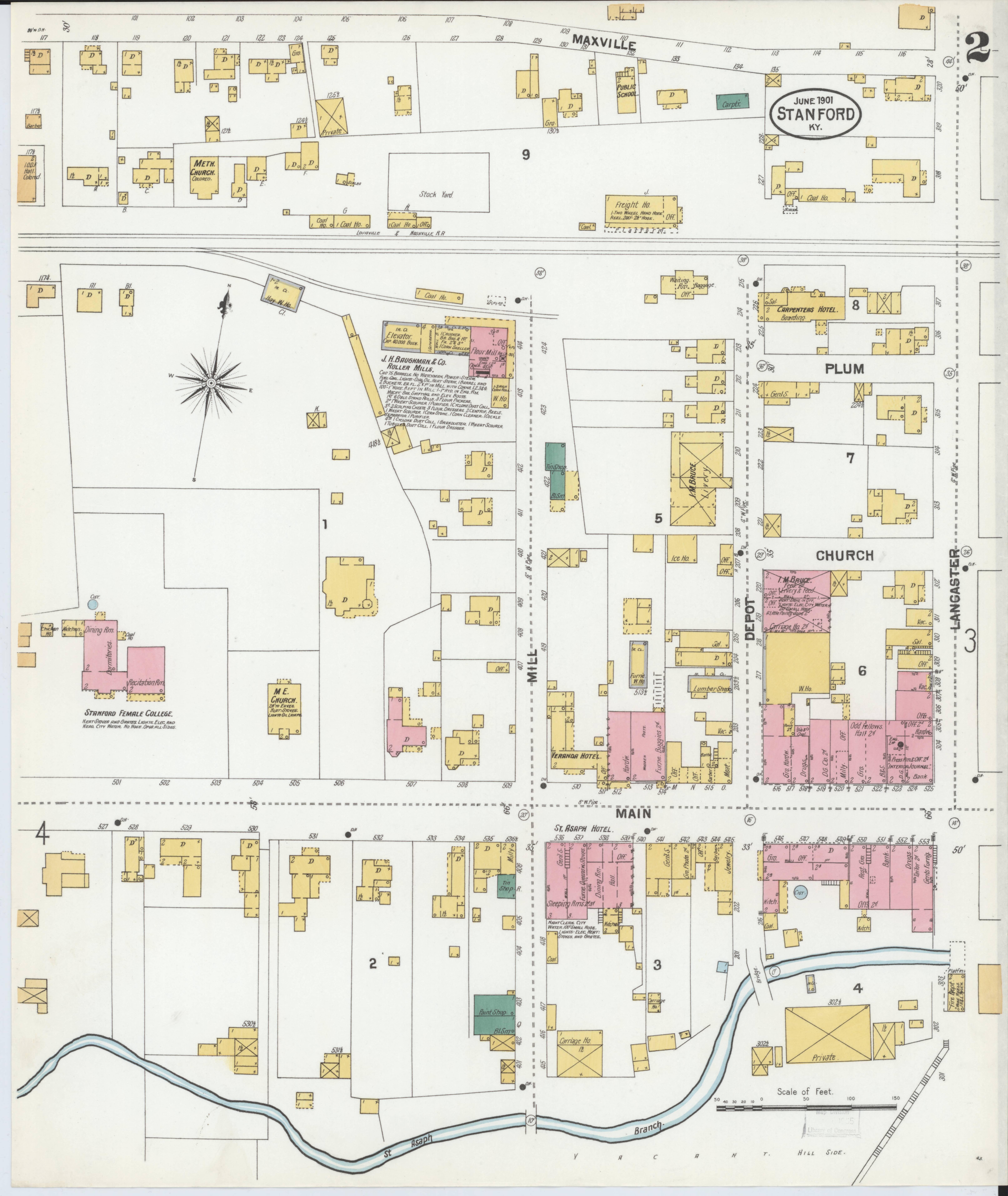
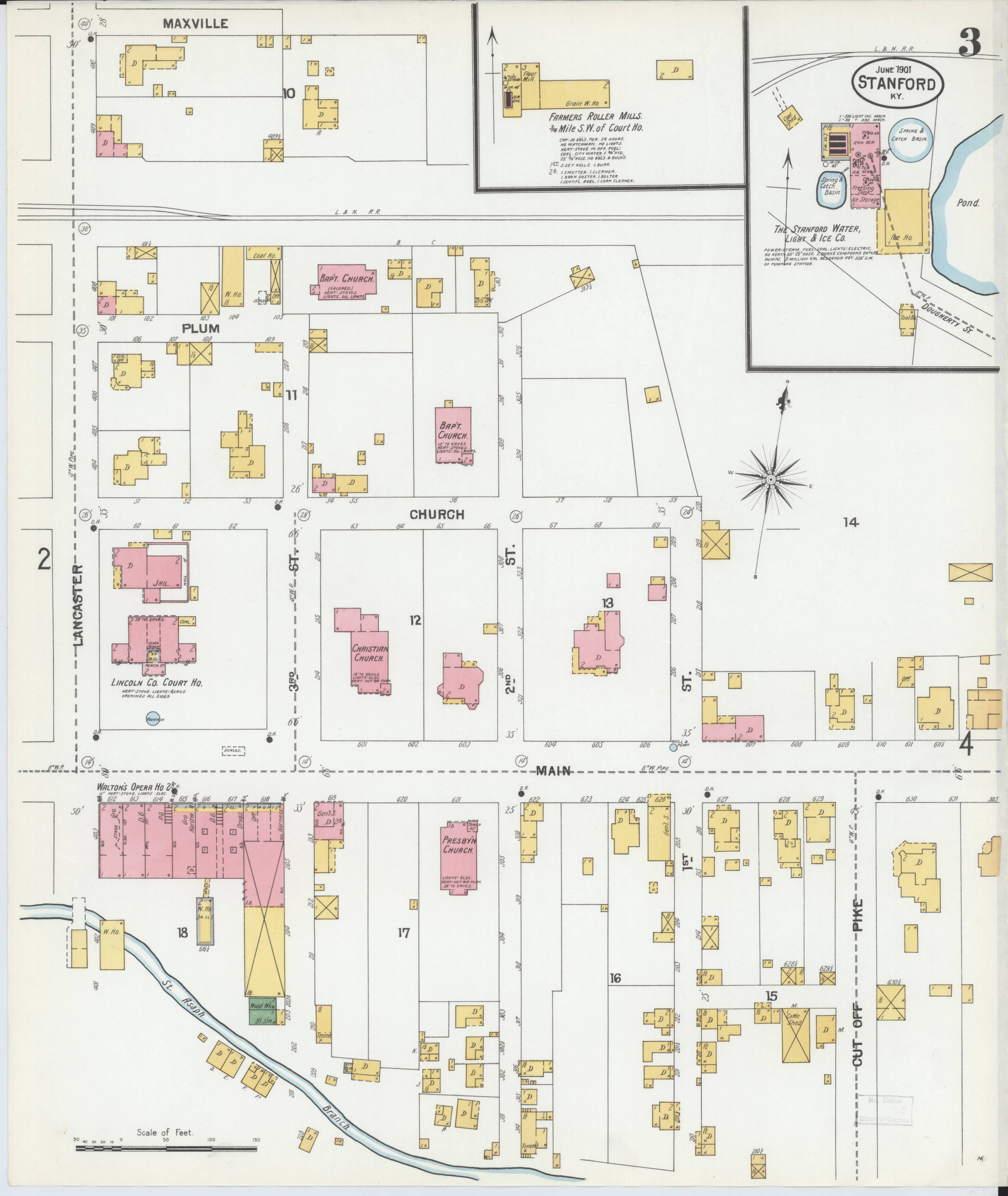
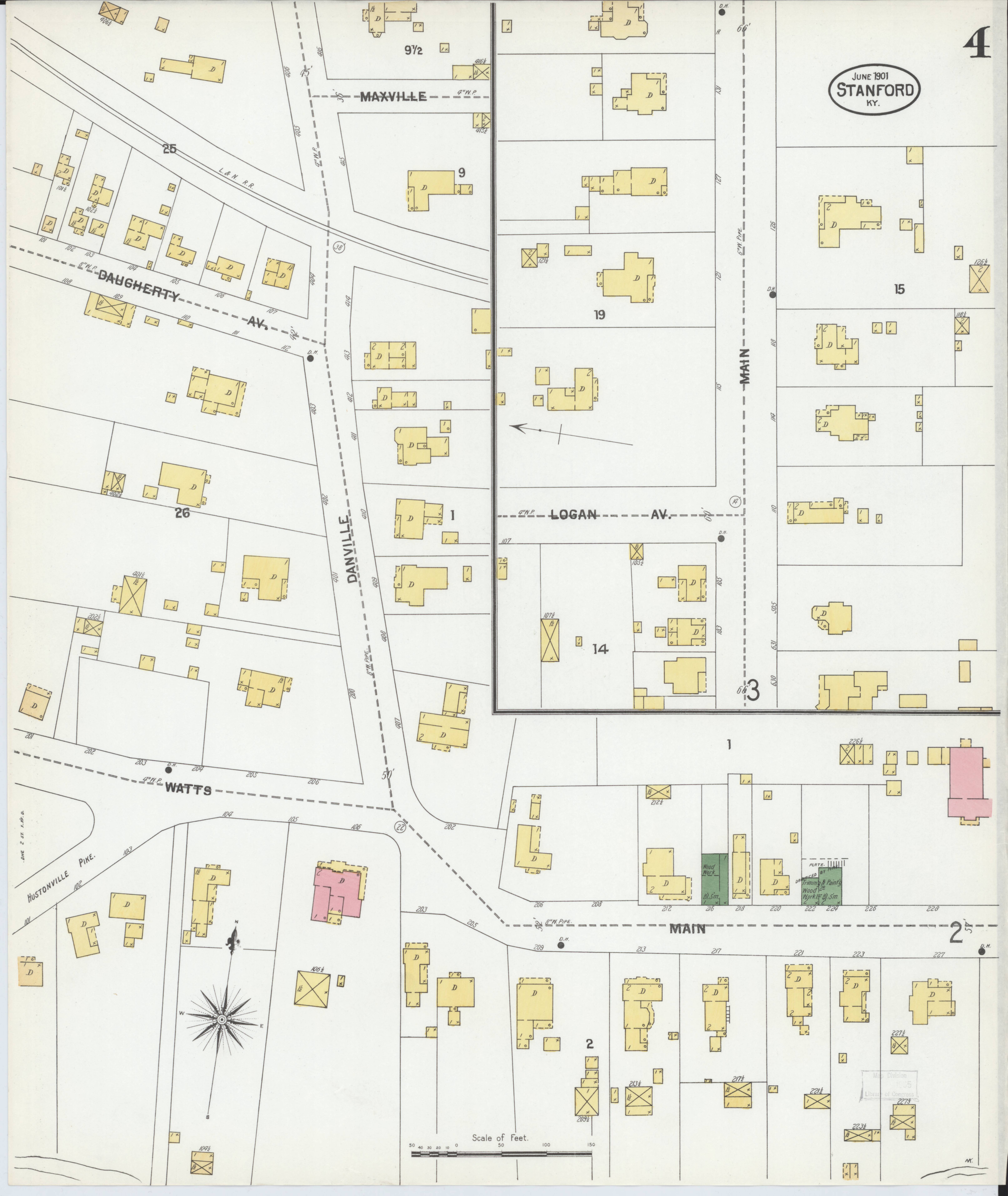
Stanford - Sanborn Insurance Maps
Sanborn maps were strictly for insurance risk assessment. Sanborn maps are now highly valued by historians, genealogists, urban planners, architects, preservationists, and environmental researchers. They provide an unmatched visual record of how American cities and neighborhoods evolved over decades, showing changes in building use, construction, and urban development.
Credit Line: Library of Congress, Geography and Map Division, Sanborn Maps Collection.
The content of the Library of Congress online Sanborn Maps Collection is in the public domain and is free to use and reuse.
Sanborn Fire Insurance Map from Stanford, Lincoln County, Kentucky. Sanborn Map Company, Oct, 1901. Map. https://www.loc.gov/item/sanborn03247_001/.
1901 Sanborn Insurance Maps For Stanford
Zoom & Pan